Posts

Showing posts from August, 2014

Trip Report: Frazee Beach, California

Image
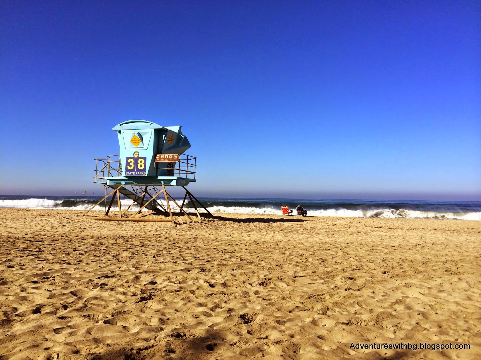
Trip Report: Frazee Beach, California Today we have another guest post, but this time its from long time college friend Athena.  She spends her time all over, like Texas and California.  While she was in California she was kind enough to write a trip report on a fun beach adventure. I like my adventures pretty casual. The less work I have to put into getting out and doing it, the better. I am a lazy adventurer. That is why one of my favorite pastimes is going to the beach, particularly, Southern California beach. The weather is almost always perfect for going out and relaxing in the cool sand and getting your feet wet in the frigid Pacific. I find myself in Carlsbad, CA (Northern San Diego) at the end of August and what a glorious time to be here it is. This is the hottest part of the year here (83 degrees Fahrenheit…ha!) and with no A/C in the house, the beach is the best place to be. These people know what’s up. I am currently conducting a weeklong end-of-summer camp

Edible Plants: The Prickly Pear Cactus

Image
Edible Plants: The Prickly Pear Cactus Today the post will be over an edible native to Texas plant, the prickly pear cactus.  The inspiration for the post is having seen so many cactus on my adventures here in south Texas.  To start with the prickly pear cactus is found all over Texas and I like the sweet taste of cactus fruit. The cactus is almost completely edible.  Just don't eat any needles, it can't be healthy for you.  Another reason to talk about the prickly pear, resulting from the excessive heat recently, this type of cactus is a hidden source of water. The Plant There are 15 species of prickly pears in North America, and each species varies slightly in its features.  The prickly pear plant in deep south Texas is green and grows between 5 and 6 feet.  In addition, the prickly pear pad grows round and flat and are also known as napol in Spanish.  Furthermore, the prickly pear also has two types of needles: long, smooth spines and short, hair-like spines.  T

Trip Report: Mission Mountain Bike Trails

Image
Trip Report: Mission Trails in Mission, Texas So here it is, the first mountain bike trip report.  It has been at least 6 months since I've ridden my mountain bike and it felt good.  I didn't take BeeGee on the first run, but when it cools off I definitely will.  Hopefully she will stay away from all the sharp plants.     Mission Trails Entrance Sign The Background Location:  26.192494, -98.330125, Mission, Tx Admission: Free Elevation: 100 to 115 ft. Weather:  Sunny, windy, hot, 90F Difficulty: Easy to intermediate Website:  http://trailsinmission.com  (unofficial) The Mission Trails center around the Mission Hike and Bike Trails, which is a paved trail maintained by the city of Mission, Texas.  The singletracks were, as far as I can tell, maintained by the Trails in Missions Club (see the link above).  However, the website looks like it isn't being operated anymore and I am not sure if the trails are being actively maintained.  Furthermore,

Outdoor News for August

Image
Three News Reports for the Month of August Today we will be taking a look at some of the outdoor news in Texas and around the country.  Two issues have occurred within the last week and once in the beginning of August: The International Mountain Biking Association (IMBA) released its epic trails, Texas Parks and Wildlife Department (TPWD) purchased the Powderhorn Ranch, and the United States Department of Agriculture (USDA) has announced budget needs for firefighting. International Mountain Biking Association August 6 th , The IMBA announced its epic trails for 2014.  Epic trails are required to be demanding, backcountry adventures in a natural setting.  In addition, the trail must be 80% single track (limited use of roads) and a minimum length of 20 miles.  This year’s Epic Rides : ·          Australian Alpine Epic Trail, Australia ·          Cannell Trail, Sherman Pass, CA ·          Goodwater Trail, Lake Georgetown, TX ·          Grand Targhee Loop, WY ·       

Recipe: Mash Potatoes and Salami

Image
Mash Potatoes and Salami For a quick post and another blog first, I will be posting one of my favorite backpacking recipes.  When I am backpacking I try and balance good taste and light weight.  This recipe is fairly compact and has a decent calorie density.  The combined meal has 282 calories. Ingredients ¼ of your favorite salami 1 packet of instant mashed potatoes 2 tablespoons of ghee/butter or 1.5 tablespoons of olive oil 1.5 tablespoons of powdered milk Your favorite seasonings At Home Write the liquid instructions on the mashed potatoes package or on the container you plan to carry this meal.  For your oil, you can use butter, olive oil, or ghee.  If the weather is nice feel free to use butter, but if its hot switch to ghee (ghee is butter that has had its liquid portion boiled away) or olive oil because they pack easier.  Finally, add your powdered milk to a small container. Labeled Mashed Potatoes, so I don't forget  On the Trail

Gear Review: Liberty Mountain Tick Key

Image
Gear Review: Liberty Mountain Tick Key For today’s post, I will do our first gear review.  The piece of equipment under review is the Tick Key by Liberty Mountain, which has become an important tool for both BeeGee and me.  This tool is one our essential pieces and always goes with us in our first aid kit. You can check out the website  here . The Tick Key The Background Unfortunately, according to the CDC, the prevalence of tick borne illnesses is increasing and new diseases are being discovered.  Therefore, it is important to dress appropriately to prevent ticks from grabbing on to you.  However, sometimes a sneaky tick finds its way to your skin anyway, or if you are like BeeGee, such option does not exist for you. We first learned about the tick key after hiking in North Carolina, where we lived for a year.  After multiple hikes where I brushed over 200 ticks off my pants and pulled over 50 ticks off BeeGee, we decided we needed an easier way to remove ticks

Texas Regions

Image
The Many Regions of Texas Texas, being a large state has a variety of regions to visit and explore.  Each region will be beautiful in its own way and will present its own issues that will need to be overcome to adventure there.  I will cover the different regions using the Omernik level III ecoregions.  This system was developed in 1987 by (you guessed it) Omernik.  The system has been adopted by the EPA and other governmental Agencies.   The Regions and Counties of Texas Arizona/New Mexico Mountains The Arizona/New Mexico Mountain Region barely enters Texas, but it is present nonetheless.  These mountains have lower elevation than surrounding mountains and have vegetation present from drier climates.  The Guadalupe Mountains National Park is found in this region. Central Great Plains This region is slightly lower in elevation than the neighboring high plains.  In addition, it receives a little more rain as well.  The region is mostly croplands now, but was once

Firearm Safety 101

Image
Introducing Jack Today we have our first guest post written by my brother Jack (I know moving up in the world!).  To find out a little more about him check out his Facebook .  Jack is another outdoor enthusiast, but has a special like for firearms and using them safely.  Therefore, for his first post Jack will talk about gun safety. Here is Jack and BeeGee at Palmetto State Park Firearm Safety 101 Shooting firearms can be some of the most fun anyone can have.  Perhaps you enjoy recreational shooting or maybe you carry one for personal protection from animals while on a camping trip or from bad people while you sleep or both.  Whatever the reason for owning a firearm, you must always remember that safety comes first.  Safety will prevent accidents and can save lives and allow everyone to have a good time and feel safe The following rules are for everyone to follow.  If you handle firearms at all, make sure you read and understand these rules before using a firearm. Firea

Trip Report: Palmetto State Park

Image
Trip Report: Palmetto State Park On Wednesday, August 6th My Brother, BeeGee, and myself went on our second official trip since starting this blog.  I hope to keep visiting interesting places throughout Texas and reporting back so the information is freely available. BeeGee & Jarrett and BeeGee & Jack Looking Cool at the Entrance Sign The Background Location:  78 Park Road 11 South,  Gonzales, TX 78629 Admission: $3 per adult; Children under 12 are free Elevation: 480 to 600 ft. Weather:  Sunny, hot, 82 to 90F Difficulty: Easy Website:  http://www.tpwd.state.tx.us/state-parks/palmetto Palmetto State Park is located in Gonzales County and is close to Gonzales and Lulling, Texas.  The San Marcos River runs through the park and there is a 4-acre lake as well.  The park offers hiking, camping, RV hook ups, fishing, canoeing, tubing, paddle boating, a cabin to rent, and a pavilion to rent.  Canoes, tubes, and paddleboats can be rented and used in O